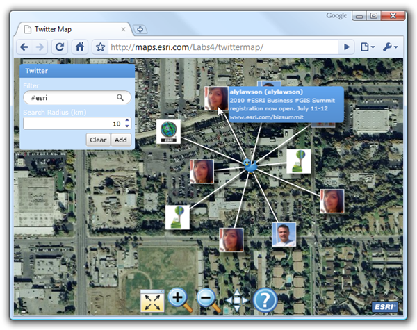
Ever wonders what people are talking about at a particular location? This application, developed by the ESRI’s Applications Prototype Lab, uses Twitter’s search API and ESRI’s Silverlight API to request and display geo-referenced tweets. The application is accessible from the following link.
http://maps.esri.com/sldemos/twittermap/default.aspx
To use, first zoom into an area of interest (preferably an urban area). Click the Add button in the upper left hand corner of the application and then click once on the map. The ten most recent tweets within the search radius will be added to the map using the tweeter’s profile image. Mouse-over the profile images to read the tweets themselves. Next, try refining your search with a smaller (or larger) search radius and the inclusion of a search keyword like #esri.
The following technologies were used to develop this application:
- Microsoft Silverlight 3
http://silverlight.net/ - ESRI’s ArcGIS API for Silverlight version 1.1
http://resources.esri.com/arcgisserver/apis/silverlight/ - Microsoft Silverlight Toolkit (November 2009)
http://www.codeplex.com/Silverlight - Linq to Twitter
Comprehensive LINQ provider to Twitter’s API
http://linqtotwitter.codeplex.com/ - Orbifold’s Graphite for Silverlight
Simple framework for presenting spring-enabled node-edge diagrams.
http://www.orbifold.net/default/?page_id=1270
